The Dakota Scout

The Dakota Scout

Share this post

The Dakota Scout
The Dakota Scout
McCook Lake flood scenarios show how levee controlled water flow
Copy link
Facebook
Email
Notes
More

McCook Lake flood scenarios show how levee controlled water flow

Governor’s office releases maps as flood response questions linger

Joe Sneve's avatar
Austin Goss's avatar
Joe Sneve
and
Austin Goss
Jul 03, 2024
∙ Paid
4

Share this post

The Dakota Scout
The Dakota Scout
McCook Lake flood scenarios show how levee controlled water flow
Copy link
Facebook
Email
Notes
More
8
Share
The top image shows flood damage with the construction of a levee on I-29, the bottom shows damage without. (Governor Noem’s office)

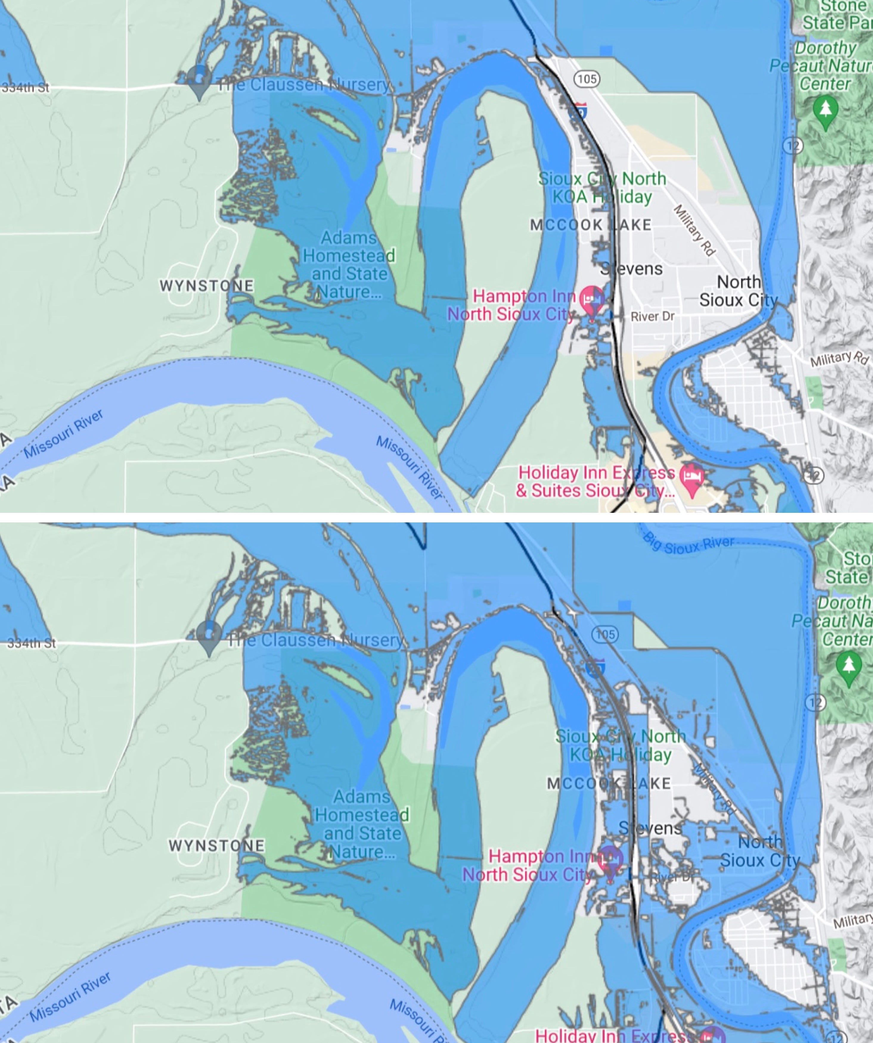
Newly-released flood modeling suggests that the devastation at McCook Lake was not caused by an emergency levee.

Gov. Kristi Noem’s office Tuesday evening released two flood modeling scenarios and a timeline of the state’s response to the emergency. Compiled by the South Dakota Flood Information System, the maps show the emergency levee built in the evening hours of June 23 kept significant portions of North Sioux City from being overtaken with water.

Absent the levee, the modeling shows North Sioux City and Dakota Dunes flooding would have been catastrophic.

NEWS: AG says punishment for threats to Gov. Noem, judge highlight need for stiffer penalties

Keep reading with a 7-day free trial

Subscribe to The Dakota Scout to keep reading this post and get 7 days of free access to the full post archives.

Already a paid subscriber? Sign in
© 2025 The Dakota Scout
Privacy ∙ Terms ∙ Collection notice
Start writingGet the app
Substack is the home for great culture

Share

Copy link
Facebook
Email
Notes
More